Quick answer
The basin sits roughly 100–125 metres below sea level, so descending air compresses and warms, while its position near 14°N delivers near-vertical sun for much of the year. Add negligible vegetation, almost no rainfall and dark volcanic ground that re-radiates stored heat after dark, and daytime figures above 45°C become routine rather than exceptional. Access here is restricted and requires an organised tour.
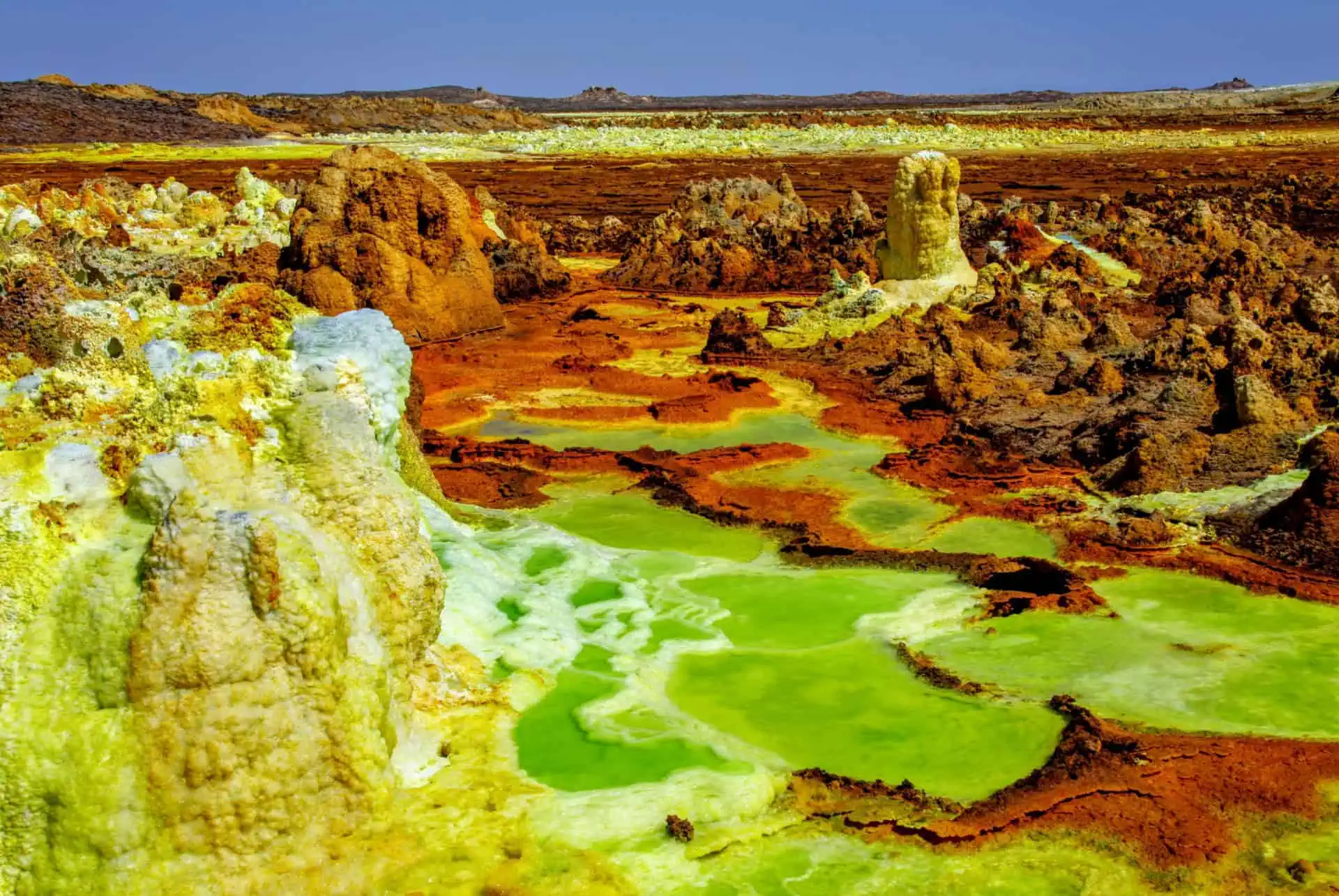
In the summer months, night in the Afar lowlands offers little relief: the ground itself continues to release the heat it absorbed all day, and pre-dawn readings can still sit above body temperature. That single detail explains more about the region than any single record figure. Anyone asking why is the danakil depression so hot is usually expecting one cause, when the honest answer involves four or five that reinforce one another. Start with position. The basin lies in the Afar Triangle, a rift zone in northeastern Ethiopia stretching towards Eritrea and Djibouti, at a latitude where the sun passes close to overhead for a large part of the year. Then subtract altitude. Rather than sitting on the Ethiopian highlands — where Addis Ababa's two-thousand-metre elevation keeps evenings genuinely cool — the depression sits below sea level, in one of the lowest continental basins on Earth. Air sinking into that hollow compresses and warms as it descends, a straightforward consequence of pressure that adds several degrees before any other factor is counted. There is no meaningful vegetation to cool the surface through transpiration, no lake system of any scale, and rainfall measured in a handful of millimetres a year. Surrounding escarpments trap air in the basin rather than letting it flush through. Cross-referenced against the Ethiopian highlands climate, the contrast is not gradual — it is a wall. Then there is what lies underneath. The Danakil is one of the few places where a mid-ocean-style spreading centre is exposed on dry land, which is why Erta Ale sustains one of the planet's longest-lived lava lakes and why the Dallol hydrothermal field paints its salt crust in sulphur yellow, iron red and copper green. Magma sits close to the surface. Brine circulating through that heat surfaces at temperatures that would scald, and the dark basalt and salt pans absorb solar radiation efficiently and give it back slowly. The salt flats worked by Afar caravans, where slabs are still cut by hand and carried out by camel, are functioning radiators. Understanding why is the danakil depression so hot therefore means accepting that both the sky and the ground are contributing, and that neither takes a night off. What should a reader do with this? Treat the heat as the organising constraint of the entire trip rather than a discomfort to be tolerated. It is the reason the area cannot be visited independently: access is restricted and organised tours are mandatory, with vehicles, water supply, local Afar guides and escorts arranged in advance. It is the reason itineraries are built around dawn and dusk movement, with the middle of the day spent under shade or in transit. It is the reason a Danakil Depression tour is measured in a handful of nights rather than an open-ended stay, and the reason operators run the route only in defined windows. A visitor who books with that framing intact — and who reads the dedicated sections on timing, permits, transport and kit before committing — arrives prepared for a landscape that is genuinely hostile and genuinely worth seeing, rather than surprised by a number they had already read.
“Both the sky and the ground are contributing, and neither takes a night off.”
Navigating the Landscape: Why Is the Danakil Depression So Hot and Difficult to Reach?
The Danakil Depression is located in the Afar Region, Ethiopia, and is accessible exclusively via organized 4x4 convoys. Due to the extreme thermal conditions and remote terrain, independent travel is not possible.
4x4 convoy from Mekele to Afar Region
4x4 convoy from Semera to Afar Region
Operational Access: Why Is the Danakil Depression So Hot and Restricted?
The Danakil Depression remains accessible throughout the week, though formal access is strictly regulated and requires organized tour participation for safety.
| Monday | 00:00–23:59 | |
|---|---|---|
| Tuesday | 00:00–23:59 | |
| Wednesday | 00:00–23:59 | |
| Thursday | 00:00–23:59 | |
| Friday | 00:00–23:59 | |
| Saturday | 00:00–23:59 | |
| Sunday | 00:00–23:59 |
Essential Preparation: Why Is the Danakil Depression So Hot and Demanding on Gear?
Preparation for the Danakil is gear-driven: heat, salt flats and volcanic terrain punish anything improvised at the last minute.
-
Book an organised tour weeks ahead — Access is restricted and requires an organised operator with permits and escorts.
-
Carry passport and permit paperwork — Checkpoints across the Afar Region verify identity before you continue.
-
Plan 4-6 litres of water daily — Sweat losses at these temperatures outpace normal drinking habits by a wide margin.
-
Pack electrolyte salts or rehydration sachets — Water alone will not replace the sodium you lose in continuous heat.
-
Wear loose long-sleeved cotton or linen — Covered skin stays cooler than bare skin under direct sun and reflected salt glare.
-
Bring wide-brimmed hat and wraparound sunglasses — Salt flats reflect light upward, so brims and side coverage matter more than usual.
-
Break in sturdy closed boots — Sharp salt crusts and lava fields cut through sandals and thin soles.
-
Carry a headtorch and dust mask — Night moves and sulphur fumes are routine parts of the itinerary.
Check availability
Frequently Asked Questions About The Danakil Depression
Everything you need to know about why is the danakil depression so hot