Quick answer
There is no single gate fee — entrance is 0 USD — because the Danakil can only be reached on a mandatory pre-arranged tour package. The landscape itself has no closing time, listed as 00:00–23:59 every day, though the recommended arrival window is 06:00–10:00, when lower sun and cooler air make Dallol's mineral crusts legible and midday heat is still hours away.
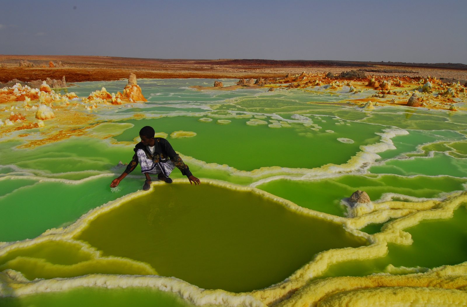
The floor of the Danakil Depression sits roughly 125 metres below sea level, and the abandoned potash works at Dallol have logged one of the highest annual mean temperatures ever recorded in an inhabited place. That single statistic explains most of what ends up in a traveller's photo library afterwards. Colour here is chemical rather than botanical: acid ponds tinted by iron and sulphur, salt crusts stained ochre and lime, black basalt fields around Erta Ale where a persistent lava lake churns inside the summit crater. Most danakil depression tours photos circulating online were taken within a few hundred metres of four or five recurring vantage points, which is why so many of them resemble one another. Understanding why the frames repeat, and how geology, permits and convoy routing shape them, is more useful than chasing an original angle. The region rewards research more than improvisation. Access is the first thing the pictures do not show. The depression lies in the Afar Region of north-eastern Ethiopia, reached overland from Mekele through Berahile and the escarpment road, and independent travel is not permitted: every visitor arrives inside an organised convoy with Afar guides and, on most routes, a local escort. Distances are long and the surface is unforgiving, so the convoy sets the pace. Nothing is fenced or gated, which is why the entrance figure is nil and why the day is dictated by heat rather than by opening times. Camel caravans still load slabs of halite at Lake Asale for the trek toward the highlands, and the salt workers of Hamed Ela are framed almost as often as the terrain. That raises a question worth settling before departure. Photographing people at work is a matter of consent rather than opportunity, and a guide will translate the request into Afar or Amharic. A Danakil photo tour that ignores this returns a thinner archive than one that pauses. Expect the light to be uncooperative for much of the day, and expect dust in every seal and hinge. Between roughly November and March the daytime maximum is manageable, while summer readings on the salt flats regularly pass 45C and operators thin their departures accordingly. Anyone comparing Afar Region landscape photography from different months will notice the gap immediately: the yellows at Dallol flatten under a vertical sun, and the glow above Erta Ale only registers after dusk. The practical conclusion is straightforward. Treat published images as a survey of what the terrain can offer, then read the dedicated timing, route and packing sections of this site to work out which departure suits the frames worth having. Compare the sequence of stops between operators, since one extra night at the volcano changes the possibilities far more than any lens will. Check the calendar early, because places on the Afar convoys are finite and the cooler windows are claimed months in advance. Little of that context survives in a caption. Studied properly, danakil depression tours photos work as a planning document rather than a souvenir.
“Colour here is chemical rather than botanical: acid ponds tinted by iron and sulphur, salt crusts stained ochre and lime.”
Top Danakil Depression Tours Photos Locations
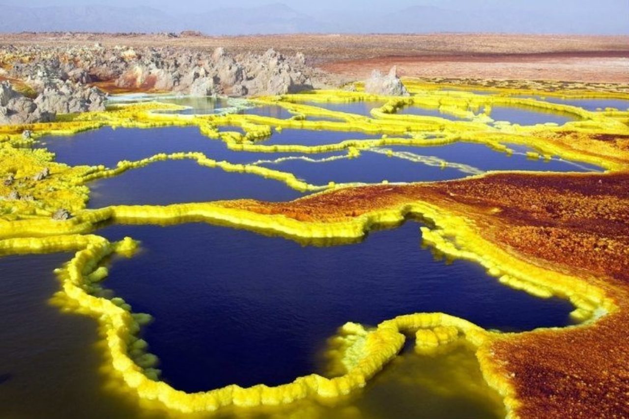
Dallol Sulfur Springs
Capture the high-contrast yellow, orange, and green mineral deposits from a low angle to emphasize texture.
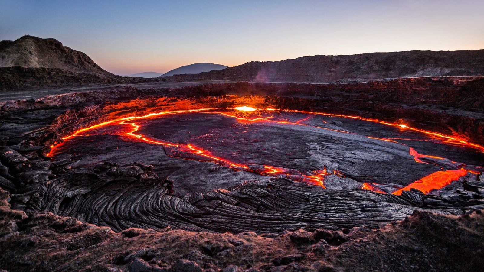
Erta Ale Lava Lake
Photograph the active molten lava against the dark crust from the crater rim at night.
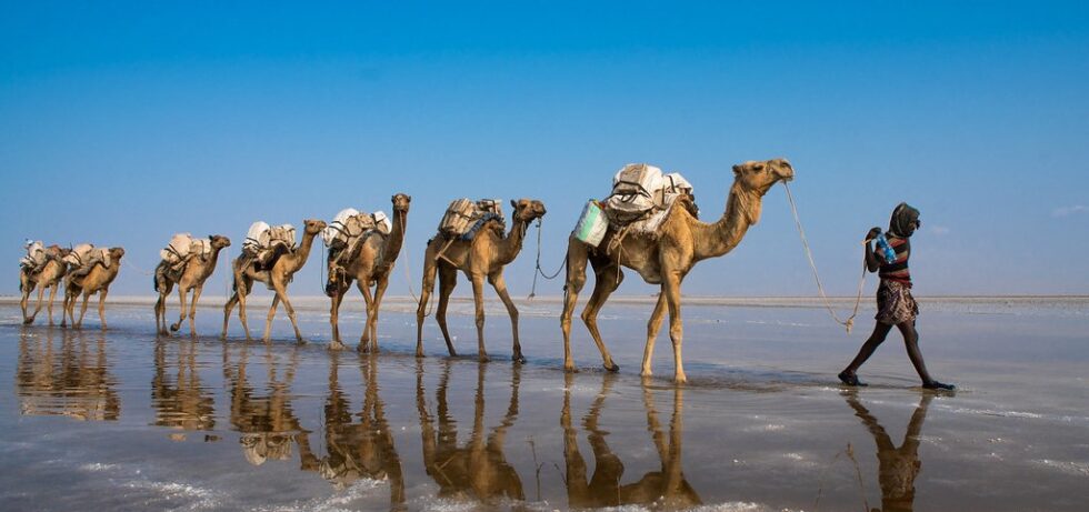
Lake Assal Salt Flats
Position the camera low to the ground to capture white salt polygons reflecting the sky.
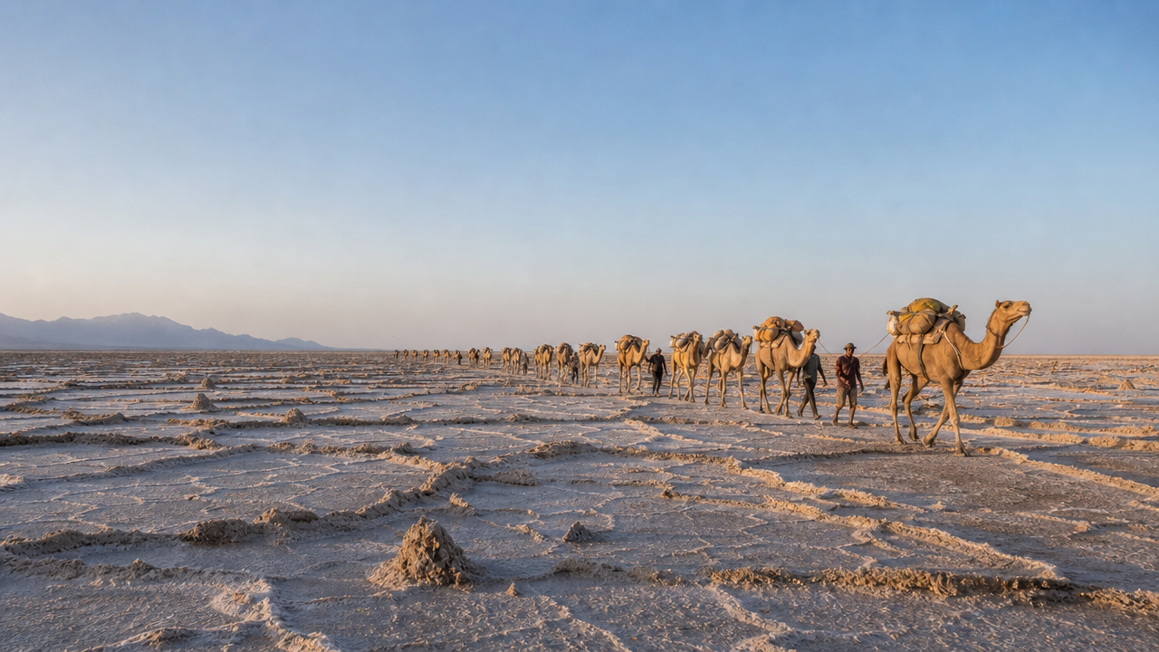
Danakil Depression Salt Caravans
Document the long lines of camels traversing the salt pans during the cooler travel hours.
Planning Danakil Depression Tours Photos Itineraries
This four-day sequence suits first-time visitors travelling from Mekele on a pre-arranged tour who want the Danakil's main landmarks without back-to-back long drives. Most operators run it as a four-day, three-night loop covering Dallol, Lake Assale and Erta Ale.
Mekele to Hamed Ela
Convoy departs Mekele and descends roughly 4-5 hours through Berahile to the salt-flat settlement of Hamed Ela. Expect a checkpoint stop in Berahile where permits and Afar guides are registered.
Dallol and Ragad
Short drive plus a 15-20 minute walk onto the Dallol sulphur terraces, then the salt-cutting fields at Ragad and the Black Mountain. Ground here is crusted and uneven, so keep to the guide's line.
Lake Assale flats
Return via Lake Assale for the shallow reflective flats and the camel caravans forming for the evening haul. Allow 60-90 minutes before light drops.
Transfer to Erta Ale base
A long transfer, typically 5-7 hours over lava fields to the base camp at Dodom, with a rest block through the hottest hours. This is a driving day, not a sightseeing one.
Ascent to the caldera
Guided walk of roughly 3 hours to the summit rim, overnighting in stone shelters near the crater. Pace is slow and the trail is loose basalt.
Crater rim then return
A second short rim visit at first light before descending to Dodom and driving back to Mekele, arriving late afternoon or evening. Build a buffer day if you have onward flights.
Essential Preparation for Danakil Depression Tours Photos
Salt, heat and airborne dust in the Afar Region attack camera gear and bodies faster than most travellers expect, so preparation runs from weeks ahead to the moment you step out at dawn.
-
Service your camera weeks ahead — Salt crystals and grit accelerate wear that a pre-trip clean and seal check can offset.
-
Pack sealed bodies and lenses — Weather-sealed equipment survives the fine salt dust that penetrates unprotected mounts and zoom barrels.
-
Bring rain covers and dry bags — Plastic covers block corrosive salt spray near the brine pools and sulphur fields.
-
Carry double the batteries and cards — Heat drains cells quickly and there is no reliable charging point in the depression.
-
Add a blower, brush and microfibre cloths — Never wipe salt dust dry off a lens; lift it off first to avoid scratching the coating.
-
Pack closed shoes, gloves and a respirator mask — Sharp salt crusts, acidic ground and sulphur fumes make thin footwear and open skin a hazard.
-
Wear a wide brim hat, UV sunglasses and long sleeves — Ground reflection off white salt doubles your sun exposure at midday.
-
Be gear-ready by the 06:00–10:00 arrival window — Loading kit in cool early light avoids extreme midday heat and gives the clearest visibility.
Check availability
Common Questions About Danakil Depression Tours Photos
Everything you need to know about danakil depression tours photos